Lawrence Aviation Superfund Site Reuse Feasibility Study

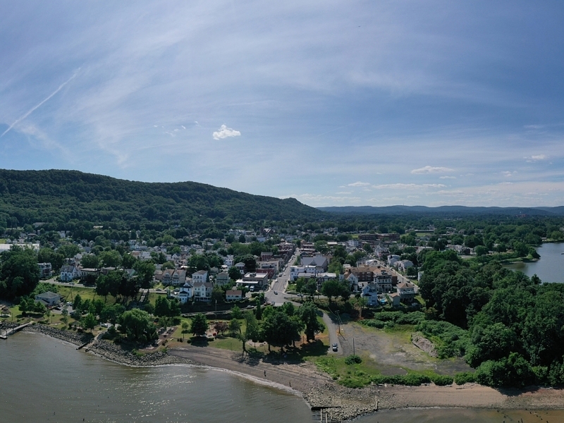
Project Location: Port Jefferson Station, NY
Client: Suffolk County Landbank Corporation
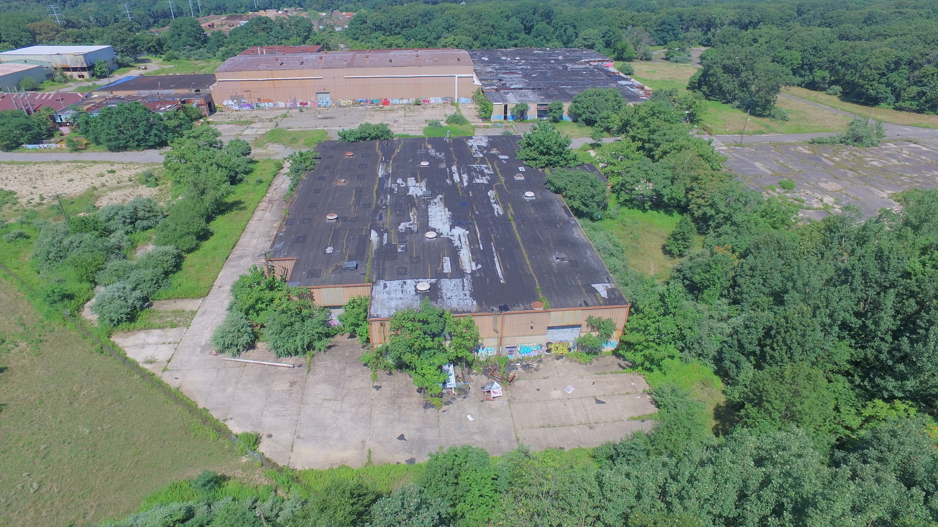
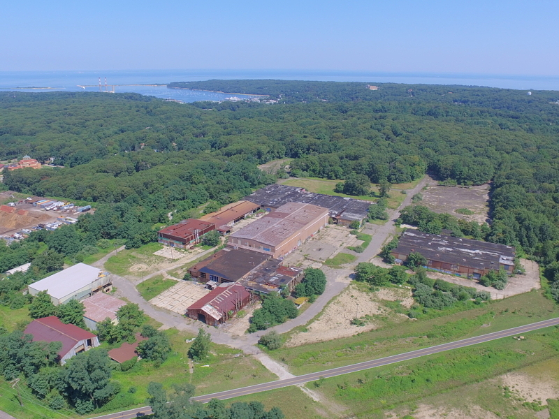
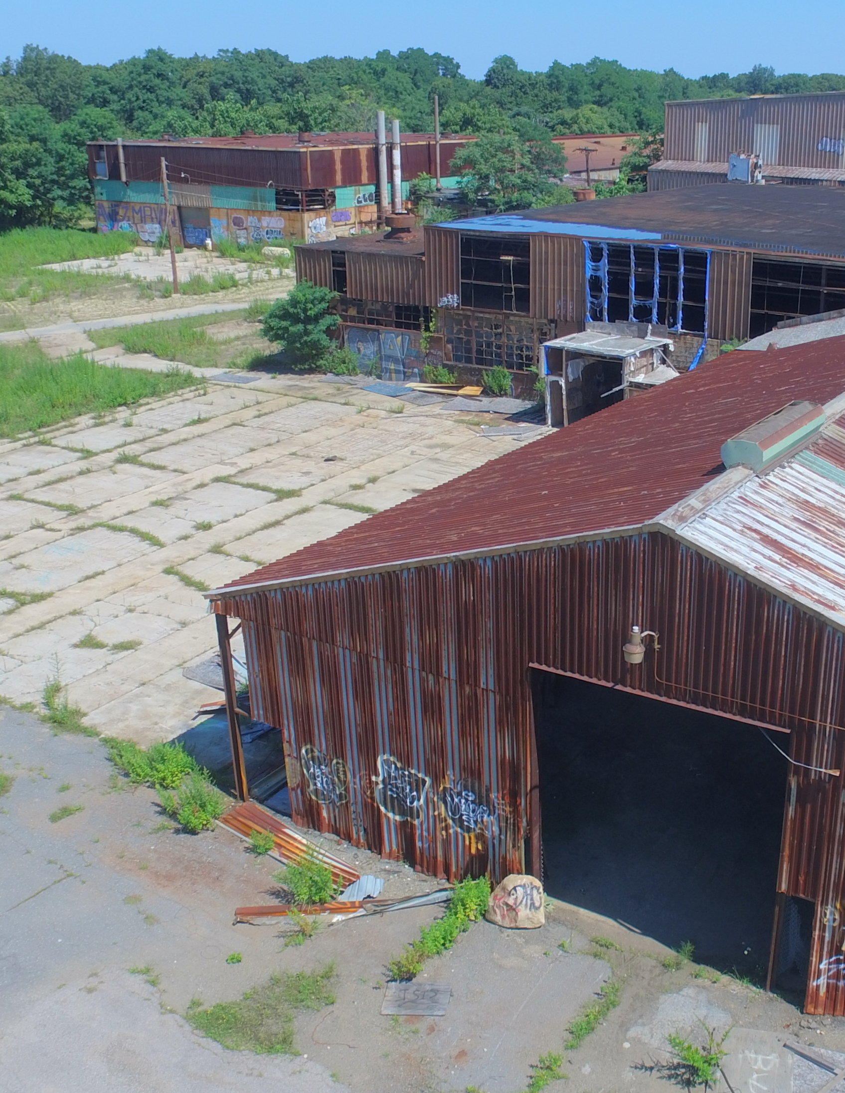
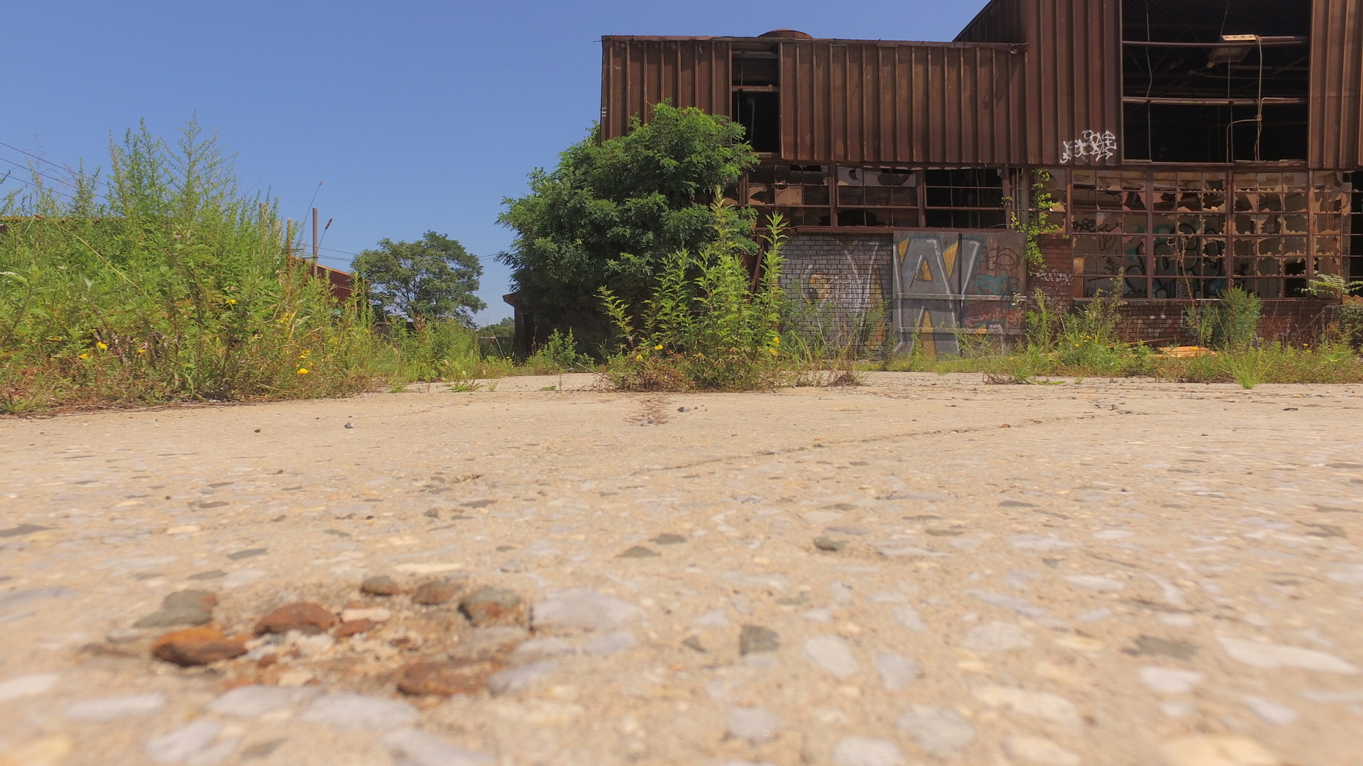
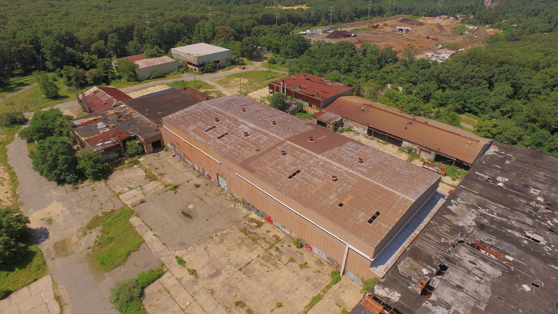
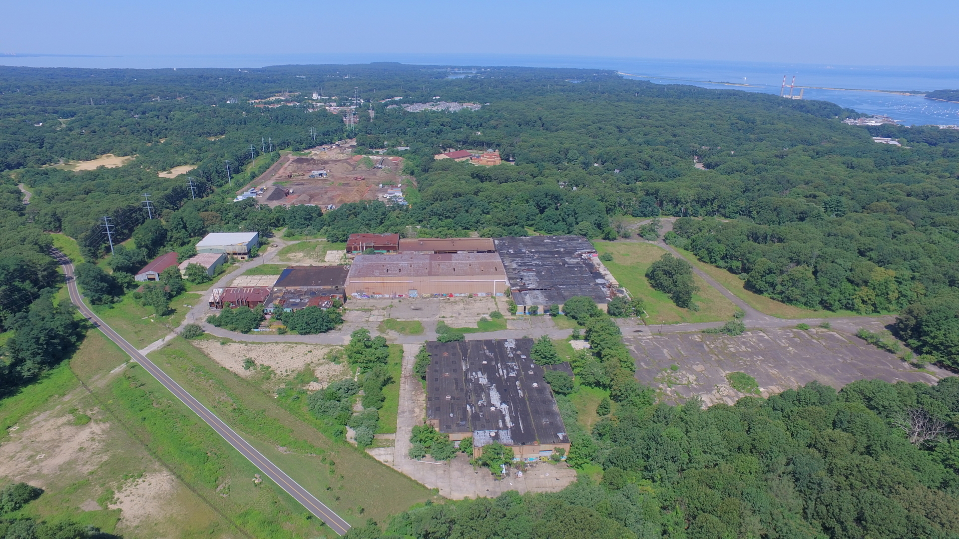
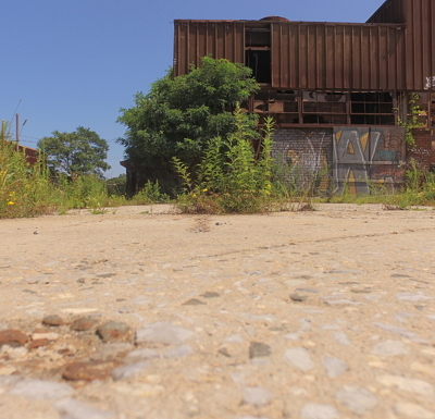
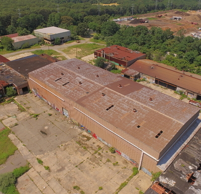
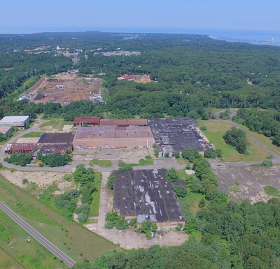
NPV was retained by the Suffolk County Landbank Corporation (SCLBC) to prepare a Site Reuse Feasibility Study for the 125-acre Lawrence Aviation Industries Superfund site that is located in the hamlet of Port Jefferson Station, Town of Brookhaven, New York. The goal of Feasibility Study, which was completed in early November 2017, was to help the SCLBC to identify the highest and best use of the subject property so that it can be marketed for sale to a developer with the goal of being put back into productive use and back on the tax rolls.
This reuse feasibility study considers a variety of factors and included an inventory of the existing setting and surrounding area; identification of factors that influence redevelopment potential of the site such as surrounding land use, land use plans, zoning, roadway access, topography and environmental history; review of available environmental documentation from the United States Environmental Protection Agency and New York State Department of Environmental Conservation and identification of the potential need for additional testing requirements prior to redevelopment; the preparation of a market trends analysis to identify potential reuse options; preparation of conceptual site reuse alternatives; incorporation of a property baseline appraisal and variations for each redevelopment scenario; and, preparation of a comparative analysis of redevelopment scenarios including building area, number of lots, relative valuation, tax generation, job creation and economic impacts, and approvals to assist the SCLBC in making a decision regarding purchase of tax liens on the property to allow sale of the property and ultimately redevelopment.
This project was unique and interesting in that it blended many of the disciplines offered at NPV and through our affiliated engineering firm, N+P. N+P prepared a series of redevelopment yield maps in consideration of complex constraints and needs for various uses which included but was not limited to the need for a suitable roadway access, the desire of the surrounding property owners to maintain wooded areas south of an existing greenway trail and, exclusion of areas on the property which were restricted based upon the EPA site management plan. NPV worked with a talented real estate appraiser to navigate the complexities of the potential future uses to provide relative values. The project required an array of knowledge and technical skills and project management skills to complete the project in a short timeframe constrained by the terms of the funding which are summarized below:
- Analysis of local land use plans and zoning,
- Technical knowledge related to EPA superfund sites and remediation and permitting authorities;
- Familiarity with the NY State procedures for alienation and conversion of parkland,
- Interfacing with engineers, real estate appraiser and demolition contractors;
- Identification of stakeholders and continuous outreach, and
- Ability to prepare a comprehensive yet clearly presented report to summarize the issues and constraints and provides recommendations for future action.
- Graphic maps for presentation.
Relevant Project Components:
- Land Use/Zoning Analysis
- Development Feasibility Studies
- Superfund Sites
- Fiscal and Economic Impact Analysis
- Market Studies
- Yield Maps – N+P
- Conceptual Plans – N+P
- Brownfields